Introduction: Descending With Precision on Arrivals
Modern glass-panel avionics and even many older GPS navigators offer a feature called Vertical Navigation (VNAV) — the ability to calculate and display a continuous three-dimensional descent path from cruise altitude down to a target altitude or fix. On arrivals into busy airspace, VNAV can reduce cockpit workload dramatically, help you comply with "at or above" or "at or below" crossing restrictions, and keep you on a stable, professional descent profile. But VNAV on arrivals is not an instrument approach procedure — it is an advisory capability, and that distinction carries serious operational and regulatory weight. Understanding what VNAV does, how it computes its path, where it can mislead you, and how the FAA treats it is essential knowledge for any instrument pilot.
What VNAV Is — and What It Is Not
The term VNAV is used in two distinct contexts in instrument flying. The first is approach-approved VNAV, which forms the vertical guidance component of certain instrument approach procedures — specifically, some RNAV (GPS) approaches that provide a computed glide path equivalent. These approaches are charted with specific minima and are authorized for use as instrument approaches. The second context — the one covered in this article — is advisory VNAV on arrivals and en route segments. This is the descent path calculation built into many GPS and FMS navigators that helps you plan and execute a smooth descent to meet published crossing restrictions on a STAR or arrival route.
Advisory VNAV is not a substitute for an instrument approach procedure. It does not provide approach minima, does not have the obstacle clearance guarantees of a published instrument procedure, and the FAA does not consider advisory VNAV guidance to be equivalent to approved vertical guidance. Treating advisory VNAV like an ILS or LP/LPV glidepath is a dangerous mistake — and a tested one on the instrument knowledge exam.
How VNAV Computes the Advisory Descent Path
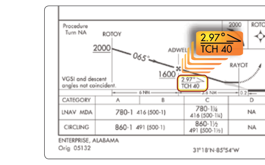
When you activate a VNAV function on a GPS navigator or FMS during an arrival, the system essentially solves a geometry problem: given your current altitude, your target altitude at a specific fix (or the runway threshold), and the horizontal distance remaining, what constant angle or rate of descent will get you there smoothly? The math is straightforward — a standard 3-degree descent angle is the default for most systems, matching the typical ILS glide path inclination.
The resulting path is displayed to the pilot as a deviation indicator — typically a magenta diamond or similar symbol on the CDI or PFD — showing whether you are above or below the computed path. You fly the aircraft to keep that indicator centered, just as you would track a glide path on an ILS. The key difference: this path has no published obstacle clearance. The VNAV system knows nothing about terrain, towers, or obstructions along the route unless it contains a sophisticated database that explicitly accounts for them. The path is purely geometric, computed from the waypoints and altitudes you (or the loaded procedure) have entered.
FMS vs. Stand-Alone GPS VNAV
In more sophisticated Flight Management Systems found in turbine aircraft, VNAV can account for aircraft performance — weight, engine thrust, wind, and airspeed — to build an optimized descent profile called an energy-managed descent. Airline crews use this to fly Continuous Descent Arrivals (CDAs), reducing fuel burn and noise. In general aviation, most stand-alone GPS navigators (such as the Garmin GNS or GTN series) compute VNAV based purely on geometry: a straight-line angle between your current position and altitude and the target waypoint altitude. Neither version provides obstacle clearance guarantees.
Crossing Restrictions on STARs: Why VNAV Helps
Standard Terminal Arrival Routes (STARs) frequently include multiple altitude crossing restrictions — for example, "cross MERIB at or above 10,000 feet," "cross KAYOH at 8,000 feet," and "cross LUXOR at or below 6,000 feet." These restrictions are published to ensure traffic separation, obstacle clearance, and orderly sequencing into busy terminal environments. Compliance is mandatory when the STAR is filed and accepted as part of your clearance.
Managing these restrictions mentally while also handling radio communications, weather, and aircraft control is a significant workload challenge. Advisory VNAV alleviates this by computing a continuous path that threads through all entered restrictions automatically. When your FMS or GPS is correctly programmed with the arrival waypoints and their crossing altitudes, the VNAV display gives you a real-time picture of whether you need to begin descending, maintain altitude, or even level off briefly to avoid arriving too early at a restriction.
The critical habit: always verify that the restrictions loaded into the navigator match those printed on the current chart. Database errors, non-standard clearances ("descend via" vs. "descend and maintain"), or controller-amended restrictions can all cause a mismatch between what your avionics compute and what you are actually supposed to do.
"Descend Via" Clearances and VNAV
A relatively modern ATC phraseology — "descend via" — is directly connected to VNAV operations. When a controller issues a clearance such as "descend via the TORIN FOUR arrival," the pilot is being authorized to descend in accordance with the published crossing restrictions and lateral route of that STAR simultaneously. This is different from a traditional clearance to "descend and maintain" a specific altitude, which cancels any published altitude restrictions between your current position and the clearance limit.
Under a "descend via" clearance, all published altitude restrictions are mandatory — not advisory. VNAV is the tool you use to comply with them, but the restrictions themselves carry the full weight of an ATC clearance. If your navigator fails or the VNAV path appears unreliable, you must revert to manual computation and notify ATC. Flying through a crossing restriction — even by a few hundred feet — under a "descend via" clearance is a violation, not merely a deviation from an advisory path.
Key Numbers and Rules
- Standard descent angle: Most VNAV systems default to a 3-degree path, equating to approximately 300 feet per nautical mile of descent (or roughly 5.2% gradient).
- Obstacle clearance: Advisory VNAV provides no guaranteed obstacle clearance. Only published instrument procedures (including charted VNAV approaches with LP/LPV or LNAV/VNAV minima) carry FAA-assured obstacle protection.
- "Descend via" = mandatory restrictions: All published altitude crossing restrictions on the STAR become binding ATC instructions under a "descend via" clearance (AIM 5-4-3).
- Database currency: Per 14 CFR 91.205 and GPS use guidance, navigation databases must be current (28-day cycle) for IFR use. An out-of-date database means VNAV-computed paths may reference outdated waypoints or altitudes.
- Pilot responsibility: The FAR/AIM makes clear that the pilot in command is responsible for compliance with all ATC clearances and published restrictions, regardless of what the avionics display.
- VNAV ≠ approach authorization: Advisory VNAV on an arrival does not authorize you to descend below any published minimum altitude. Only a published, approved instrument approach procedure with appropriate equipment and minima does that.
Why It Matters: Safety and Situational Awareness
The most dangerous misuse of advisory VNAV is complacency — following the magenta line down without independently monitoring actual altitude against terrain, minimum safe altitudes, or ATC clearance limits. Several accidents have involved crews or pilots who deviated significantly below safe altitudes while chasing a VNAV path that was incorrectly programmed or that led toward terrain the system did not account for.
Effective VNAV use requires a dual-check mindset: trust the path display as a planning tool, but continuously cross-check actual altitude against charted crossing restrictions, your altimeter setting (especially important in cold temperatures — see cold temperature altitude corrections), and the minimum altitudes on your approach charts. VNAV is a tool, not an autopilot that guarantees safety.
Common Test Traps
- Confusing advisory VNAV with approved vertical guidance: The exam will test whether you know that advisory VNAV on a STAR does not provide obstacle clearance or authorize descent below MDA/DA. Only a published instrument approach with approved VNAV/glide path guidance does that.
- "Descend via" vs. "descend and maintain": Under "descend via," all restrictions are mandatory. Under "descend and maintain [altitude]," the published intermediate restrictions are superseded unless the controller restates them.
- Treating the VNAV path as current without verifying database: An out-of-date navigation database can produce VNAV paths to outdated fixes or wrong altitudes. Always verify database currency.
- Cold temperature errors: Standard VNAV paths are computed geometrically. In very cold temperatures, true altitude is lower than indicated altitude, meaning the aircraft may be closer to terrain than the path display suggests. The AIM and published cold temperature correction procedures address this risk.
- Failing to notify ATC on VNAV failure: If advisory VNAV becomes unreliable during a "descend via" clearance, you are still responsible for compliance. Notify ATC immediately and request alternative clearance instructions.
Practical Cockpit Tips
Build the habit of programming your STAR and arrival restrictions before departure or well in advance of the terminal area. Cross-check every waypoint altitude against the current chart. When you receive a "descend via" clearance, read it back correctly and mentally commit to treating every restriction as mandatory. Use VNAV as your primary descent planning aid, but set altitude preselects in your autopilot at each crossing restriction altitude so the aircraft physically cannot bust through a limit without alerting you. Finally, maintain instrument scan discipline — cross-check the altimeter, VSI, and any terrain awareness display throughout the descent, not just the VNAV deviation indicator.