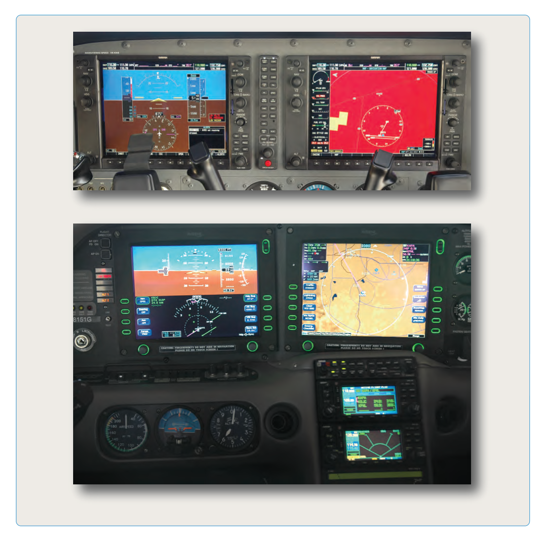
Area Navigation, universally abbreviated RNAV, is a method of navigation that permits an aircraft to operate along any desired flight path within the coverage area of navigation signal sources, rather than requiring flight directly over the ground-based stations that define those signals. The concept transformed instrument flight from a series of point-to-point hops between VORs, NDBs, and airways into a fully flexible, three-dimensional route structure. For the Airline Transport Pilot candidate, a precise understanding of RNAV principles, the waypoint types used in modern Flight Management Systems (FMS), and the performance requirements attached to each type is not merely academic — it is the daily operational language of high-altitude IFR flying.
The FAA defines RNAV in the Instrument Procedures Handbook and Aeronautical Information Manual as a navigation system that uses inputs from one or more approved navigation sources — GPS, DME/DME, VOR/DME, or inertial reference — to compute aircraft position and guide the aircraft along a defined route without requiring direct overflight of ground facilities. The performance specification attached to a particular RNAV operation is called Required Navigation Performance (RNP), and together RNAV and RNP form the framework the FAA calls Performance-Based Navigation (PBN).
How RNAV Works
At its core, the FMS continuously solves a navigation equation: it combines raw position data from one or more sensors, applies weighting algorithms (favoring the most accurate source available), and produces an estimated position called the present position. Separately, the FMS computes Actual Navigation Performance (ANP), which is not the position itself but the system's estimated current navigational accuracy — an error bound expressed in nautical miles that the crew compares against the Required Navigation Performance (RNP) value for the phase of flight to confirm the aircraft's navigation accuracy is adequate. The FMS then computes the horizontal and, on three-dimensional procedures, vertical deviation from the desired path between defined waypoints. This deviation drives the autopilot or flight director to keep the aircraft precisely on track.
Position sources each have different accuracy and availability characteristics. GPS (specifically the FAA's Wide Area Augmentation System, WAAS) provides the highest accuracy — sub-meter in many conditions — and is the primary source enabling RNAV approaches with vertical guidance (LPV, LNAV/VNAV). DME/DME position is computed by triangulating distance measurements from two or more DME stations; it is highly reliable in the en route structure but loses accuracy when the geometry is poor. VOR/DME position uses a single station's radial and slant-range distance, giving lower positional accuracy than DME/DME. Inertial Reference Systems (IRS) or Inertial Navigation Systems (INS) require no external signal but accumulate drift over time, so they are blended with radio or GPS inputs in modern systems.
Waypoint Types Used in RNAV and FMS Operations
Understanding waypoint types is central to understanding how an FMS constructs a lateral path. The ARINC 424 navigation database standard — the specification underlying all certified aviation FMS databases — defines a vocabulary of path and terminator (path/term) leg types that describe exactly how the aircraft should fly between database entries. While there are many leg codes, the ATP candidate needs to be fluent in the most operationally common ones.
Fly-Over (FO) Waypoints
A fly-over waypoint requires the aircraft to fly directly over the defined geographic point before beginning the turn to the next course. The FMS does not begin any turn anticipation until the aircraft crosses the waypoint. This type is used where obstacle clearance or airspace constraints require the aircraft to actually reach the waypoint before maneuvering. Fly-over waypoints are symbolized in most avionics as a circled waypoint symbol and are labeled in approach procedure design with specific criteria. The practical consequence is that at high speeds or when the next course change is large, a fly-over waypoint can produce a significant overshoot before the aircraft rolls into the new track — pilots must be prepared for this, particularly during missed approach segments where a fly-over waypoint may transition to a climbing turn.
Fly-By (FB) Waypoints
A fly-by waypoint is far more common in everyday FMS routing. The FMS uses turn anticipation logic: it calculates the radius of the turn needed at the current groundspeed and bank angle, and begins the turn before reaching the waypoint so that the aircraft smoothly intercepts the next course segment. The result is a rounded corner that passes abeam the waypoint, never overflying it exactly. The vast majority of en route waypoints, arrival waypoints, and intermediate approach waypoints are fly-by type. Because the turn begins early, there is no overshoot at the waypoint itself, which keeps the aircraft within the protected airspace corridor.
Radius-to-Fix (RF) Legs
An RF leg defines a constant-radius arc between two waypoints, centered on a defined geographic point called the arc center. The aircraft flies a curved path of fixed radius from one end waypoint to another. RF legs appear in Required Navigation Performance Authorization Required (RNP AR) approach procedures and certain RNAV departure and arrival procedures where obstacle clearance demands a precisely curved flight path. Executing an RF leg requires a certified FMS with coupled autopilot; hand-flying an RF leg is not permitted operationally because the required track-keeping accuracy cannot be consistently achieved manually. The RF leg is one of the key features that distinguishes RNP AR operations from basic RNAV.
Database Waypoint Categories
Beyond the path/term leg type, waypoints are also categorized by their origin and nature. Published waypoints (also called named fixes) are coded in the navigation database and have five-letter ICAO identifiers (e.g., KORRY, BRAAP) or three-letter VOR-based identifiers. Pilot-defined waypoints — created by the crew using latitude/longitude entry, place/bearing/distance, or place/bearing and place/bearing intersection — are not in the database but can be manually entered into the FMS. These are sometimes called phantom or user-defined waypoints and are particularly useful for strategic lateral offsets, oceanic waypoints, or custom crossing restrictions. Finally, along-track waypoints (ATWs) or along-track offsets allow the crew to define a point a specified distance before or after a named fix along the current route — an efficient way to set a crossing restriction at a position that has no database identifier.
Why Waypoint Types Matter for Safety and Procedure Design
The distinction between fly-over and fly-by waypoints directly affects obstacle clearance. Procedure designers at the FAA's Aeronautical Information Services use specific protected airspace templates for each type. A fly-over waypoint's template is wider because it accounts for the overshoot; a fly-by waypoint's template is tighter because turn anticipation keeps the aircraft within a predictable corridor. If a crew were to load a procedure that calls for a fly-over waypoint but their FMS executes it as fly-by (or vice versa), the aircraft could exit the protected area. For this reason, the navigation database must accurately encode waypoint type, and crews should verify that their FMS is executing the procedure as charted.
RF legs add another dimension: if an aircraft without RNP AR certification attempts an approach containing RF legs, it literally cannot execute the coded path. The FMS will typically generate a discontinuity or alert. Crews must verify the aircraft's navigation system page or AFM supplements to confirm RF leg authorization before accepting an RNP AR clearance.
Key Numbers and Rules
- Basic RNAV (Q-routes, T-routes, RNAV SIDs/STARs): typically requires RNP 2.0 en route or RNP 1.0 for terminal procedures — total system error must remain within the specified value 95% of the time.
- RNAV (GPS) approaches — LNAV minima: lateral guidance only; non-precision, uses LNAV minima on the chart.
- RNAV (GPS) approaches — LNAV/VNAV: adds advisory or computed vertical path (Baro-VNAV or WAAS); uses LNAV/VNAV DA on the chart.
- RNAV (GPS) approaches — LPV: WAAS-based lateral and vertical guidance, can reach decision altitudes as low as 200 feet HAT, comparable to ILS Cat I.
- RNP AR approaches: require specific aircraft and crew authorization; RNP values as tight as 0.1 nm lateral; RF legs permitted; missed approach may contain RF legs.
- Fly-over vs. fly-by coding: determined by the instrument procedure design criteria, encoded in the ARINC 424 database; cannot be changed by the crew.
- Navigation database currency: 14 CFR 91.103 and operator requirements mandate use of a current database for IFR RNAV operations; databases are updated on a 28-day AIRAC cycle.
Memory Aid — PBN Sensor Hierarchy
When recalling the position source hierarchy from most to least accurate for approach operations, use: "WAAS Gives Dependable Vertical Information" — WAAS/GPS (highest accuracy, enables LPV), GPS without augmentation (LNAV), DME/DME (en route and terminal), VOR/DME (en route, lower accuracy), IRS/IRS (backup, drift-limited). This is a study device, not an official FAA mnemonic, but it captures the practical decision logic crews use when evaluating what RNAV capability is available.
Common Test Traps
- Confusing fly-over and fly-by behavior: Test questions often describe an aircraft overshooting a waypoint and ask for the cause. The correct answer is that the waypoint was coded as fly-over, not fly-by, preventing turn anticipation.
- Assuming all GPS approaches provide vertical guidance: LNAV-only minima do not provide approved vertical guidance — the approach is non-precision. Only LNAV/VNAV, LPV, and GLS lines of minima include vertical path guidance.
- RF legs and hand-flying: A question may ask whether RF legs can be hand-flown on an RNP AR approach. The answer is no — coupled autopilot use is required by the procedure design and authorization criteria.
- Database currency and IFR legality: Some questions imply it is legal to fly an RNAV IFR procedure with an expired database if the pilot verifies the waypoints manually. In practice, regulations and OpSpecs require a current database; an expired database is not an acceptable substitute even with manual verification.
- RNP vs. RNAV authorization: Basic RNAV capability does not authorize RNP AR operations. RNP AR requires a separate FAA authorization (typically via OpSpec B036 for Part 121 operators), specific avionics, and trained crews — a critical distinction on ATP-level questions.