Thunderstorms are among the most dangerous phenomena an instrument-rated pilot will encounter. Unlike VFR pilots who can visually detour around buildups, IFR pilots operating in instrument meteorological conditions (IMC) may be unable to see convective cells until they are dangerously close — or until the aircraft is already inside one. The FAA is unambiguous on this point: no aircraft is certified to penetrate a thunderstorm, and no instrument rating authorizes a pilot to fly through convective activity. The skills tested on the Instrument Rating knowledge exam and practical test go beyond recognition — they demand a thorough understanding of how to avoid thunderstorms using onboard equipment, datalink weather, ATC services, and sound aeronautical decision-making (ADM).
This article follows the FAA's guidance from the Aviation Weather Handbook (FAA-H-8083-28), the Instrument Flying Handbook (FAA-H-8083-15), and the Aeronautical Information Manual (AIM) to give you a comprehensive, exam-ready, and operationally sound foundation for thunderstorm avoidance in the IFR environment.
Why Thunderstorms Are Uniquely Dangerous to IFR Pilots
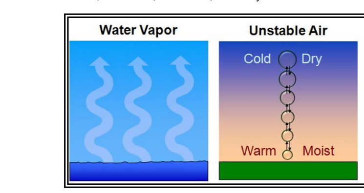
Thunderstorms produce a constellation of hazards that can overwhelm even a well-equipped aircraft within seconds. According to the Aviation Weather Handbook, those hazards include: severe or extreme turbulence (capable of structural failure), heavy icing, lightning, hail (which can fall miles from the visible cell), wind shear and microbursts, tornadoes, and precipitation-induced instrument errors. In IMC, a pilot may enter a cell through a visually imperceptible precipitation curtain. Once inside, spatial disorientation becomes a serious threat because turbulence can tumble the aircraft before the pilot can respond on the instruments.
A critical concept for IFR pilots is that radar returns — whether from ATC radar or onboard weather radar — do not always reveal the full extent of a cell. The radar bright band, beam overshoot at altitude, and attenuation (where heavy precipitation blocks the radar beam from detecting cells beyond it) can cause controllers and pilots alike to underestimate storm intensity. This is why the AIM cautions pilots never to assume a gap between radar echoes is clear of turbulence.
How Thunderstorm Avoidance Works in Practice
Minimum Separation Distances
The AIM provides specific recommended separation distances that every instrument pilot must know. These are not regulatory minimums — they are operational best practices based on accident data and the documented reach of thunderstorm hazards:
- 20 nautical miles from any severe thunderstorm or a cell showing an intense (red) return on airborne radar. Hail and severe turbulence can extend this far from the visible storm.
- Do not fly under a thunderstorm even if you can see through to the other side. The area beneath a cell is subject to extreme downdrafts, microbursts, and wind shear.
- Avoid flying between two cells when the gap is narrower than 40 nautical miles and the cells are strong or severe with radar tops above 30,000 feet — the hazard zones of intense cells can overlap in the middle, and hidden turbulence or hail may span the gap. This is a widely cited guideline rather than a fixed regulatory distance, and the qualifying factors (cell strength and top height) matter as much as the raw gap width.
- Clear the tops only if you can do so with generous vertical clearance — a commonly used rule of thumb is roughly 1,000 feet of additional altitude for each 10 knots of wind at cloud-top level, though this is not a codified FAA numeric standard, just an operational guideline. Most general aviation aircraft cannot climb above mature thunderstorm tops that can exceed 50,000 feet in any case.
Onboard Weather Radar
Airborne weather radar is the gold standard for real-time convective avoidance in IMC. It detects precipitation intensity and displays it in color-coded returns: green (light), yellow (moderate), red (heavy), and magenta (extreme). The FAA's guidance is to avoid red and magenta returns by at least 20 nautical miles and to be skeptical of any apparent gaps in returns due to attenuation. Radar tilt management is essential — pilots must regularly adjust the antenna tilt to scan both the upper and lower portions of the atmosphere ahead, because a cell that appears weak at one tilt angle may be severe at another. Onboard radar shows current conditions, making it more tactically useful than datalink weather for in-flight deviations.
Datalink Weather (ADS-B and XM/SiriusXM)
Datalink weather — whether received via ADS-B In (FIS-B) or satellite-based subscription services — gives pilots access to NEXRAD composite radar, METARs, TAFs, PIREPs, SIGMETs, and AIRMETs in the cockpit. The critical limitation is latency. NEXRAD mosaic imagery displayed in the cockpit can be several minutes old — commonly cited as potentially up to 15–20 minutes — by the time it reaches the pilot's screen, and the actual age can vary significantly, so a thunderstorm can move several miles and change intensity significantly in that time. Datalink weather is an excellent strategic planning tool for routing around broad convective areas, but it must never be used as the sole means of tactical cell avoidance in close proximity to storms. The FAA and AIM consistently emphasize this latency limitation.
ATC Radar and Pilot Deviation Requests
Air Traffic Control radar displays precipitation, and controllers can provide pilots with information about areas of precipitation along their route. However, controllers are not meteorologists, and their primary duty is traffic separation, not weather avoidance. The AIM makes clear that ATC radar is not certified or intended as a weather avoidance tool, and that controllers cannot always identify precipitation intensity or embedded cells within larger areas of returns.
That said, ATC is a valuable resource. Pilots should proactively request deviation clearances when convective weather blocks the filed route. When requesting a deviation, state your request clearly: your position, the reason (weather avoidance), and the direction or distance of deviation you need. Under 14 CFR 91.3(b), the pilot in command has the authority to deviate from any rule of Part 91 to the extent required to meet an emergency — and severe weather threatening the aircraft can qualify. Deviating from an ATC clearance itself is addressed separately under 14 CFR 91.123 and AIM 4-4-10. Always advise ATC when deviating and request an amended clearance as soon as practicable.
Pre-Flight and Strategic Planning
Thunderstorm avoidance begins long before engine start. A thorough preflight weather briefing should include Convective SIGMETs (which are issued for severe thunderstorms, embedded thunderstorms, or areas of widespread thunderstorms), AIRMETs Sierra (IFR conditions) and Tango (turbulence), and the convective outlook from the Storm Prediction Center (SPC) as discussed in the Aviation Weather Handbook. The convective outlook categorizes the risk of severe convection from marginal to high — a high-risk day is a strong signal to delay or cancel an IFR flight.
Pilots should also review PIREPs (Pilot Reports) along the route for turbulence and icing, and examine prog charts for areas of instability. A key preflight question: does the aircraft have enough fuel and alternate options to reroute around a large convective area without reaching fuel minimums? Always have a plan B before departure.
Key Numbers and Rules
- 20 NM: Recommended clearance from severe thunderstorm cells or intense radar returns.
- 40 NM gap guideline: A widely cited threshold for avoiding narrow corridors between strong/severe cells with tops above 30,000 feet, rather than a fixed rule for all cells.
- ~1,000 ft per 10 kt of wind: A commonly used rule of thumb for additional clearance above thunderstorm tops if attempting to fly over (rarely practical), not a codified FAA formula.
- Several minutes to as much as 15–20 minutes: Typical NEXRAD datalink latency, which can vary significantly — never use it for close-range tactical avoidance.
- Convective SIGMET: Issued for thunderstorms affecting a wide area, embedded thunderstorms, severe thunderstorms, or tornado activity — always check before IFR departure.
- Never enter IMC near thunderstorms without onboard radar or reliable real-time weather information and a solid escape route.
Memory Aid: STOP
When faced with a convective go/no-go decision in the IFR environment, use the STOP mnemonic to structure your thinking:
- S — Severity: How intense are the cells? Check Convective SIGMETs, radar returns, and PIREPs for turbulence and icing reports.
- T — Trend: Are conditions building or dissipating? A line of storms that is growing at departure time will be worse when you arrive.
- O — Options: What are your routing alternatives, alternate airports, and fuel margins? Do you have an escape plan?
- P — Plan B: If your primary route becomes blocked, where will you go? A pilot without a Plan B is already in trouble before the first deviation is needed.
Common Test Traps
- Assuming ATC radar is a weather avoidance tool. The AIM explicitly states it is not. Controllers provide precipitation information as a courtesy; pilots bear full responsibility for weather avoidance decisions.
- Trusting datalink NEXRAD for close-range avoidance. Latency that can run to several minutes, and at times as much as 15–20 minutes, means a rapidly developing cell may not appear on your display until you are already near it. Onboard radar or visual observation is required for tactical avoidance.
- Thinking the gaps between echoes are safe corridors. The AIM warns that areas between radar echoes may still contain severe turbulence and hail. The 40 NM gap guideline for strong/severe cells with high tops exists precisely for this reason.
- Attempting to fly below or over a storm. Below exposes you to microbursts and extreme wind shear; above is rarely achievable in GA aircraft and still carries hail risk.
- Failing to declare a deviation and notify ATC. Under 14 CFR 91.3(b), the PIC may deviate from any rule of Part 91 in an emergency and must, if requested by the FAA, send a written report of the deviation; AIM guidance further calls for notifying ATC as soon as possible. Not doing so is both a regulatory issue and a safety hazard — ATC needs to know your position.
Thunderstorm avoidance is one of the most judgment-intensive skills an IFR pilot can develop. The equipment — radar, datalink, ATC — provides information, but the decision is always yours. Build conservative personal minimums around convective weather, stay current on weather products and their limitations, and never let schedule pressure push you into a thunderstorm environment you are not equipped to handle. The FAA's guidance is clear: when in doubt, wait it out.