Thunderstorms are among the most violent and unpredictable weather phenomena a pilot — or drone operator — can encounter. While a manned aircraft pilot has the option to divert, climb, or descend to escape deteriorating conditions, a small unmanned aircraft system (sUAS) has virtually no margin for error. Convective activity that might merely inconvenience a turboprop crew can destroy a drone outright, ground it miles from the launch site, or send it crashing into people and property below. For Remote Pilots operating under 14 CFR Part 107, understanding convective weather is not optional trivia — it is a core safety and legal responsibility.
This article explains how thunderstorms form, why their associated hazards are especially severe for drone operations, how to access reliable convective weather information before and during a flight, and how to build practical avoidance habits that keep your operation legal and your aircraft in one piece.
How Thunderstorms Form
Every thunderstorm requires three ingredients: moisture in the atmosphere, a lifting mechanism to push air upward, and atmospheric instability that allows the rising air to continue ascending on its own. When all three combine, ordinary cumulus clouds can rapidly develop into towering cumulonimbus cells — the hallmark of convective activity.
The life cycle of a thunderstorm has three recognized stages. During the cumulus stage, strong updrafts dominate and the cloud builds rapidly upward. This stage is deceptively calm at the surface and is often underestimated. In the mature stage, both updrafts and downdrafts coexist within the cell; this is the most intense period, featuring heavy rain, hail, lightning, and severe turbulence. The dissipating stage is dominated by downdrafts as the storm collapses, but hazardous conditions — including gusty outflow winds and lingering turbulence — persist well into this phase. For drone pilots, no stage is safe to fly near.
Hazards Associated with Convective Activity
Thunderstorms produce a cluster of distinct hazards, each capable of ending a drone flight catastrophically. Understanding each one helps you appreciate why even a storm that appears distant deserves serious respect.
Turbulence and Wind Shear
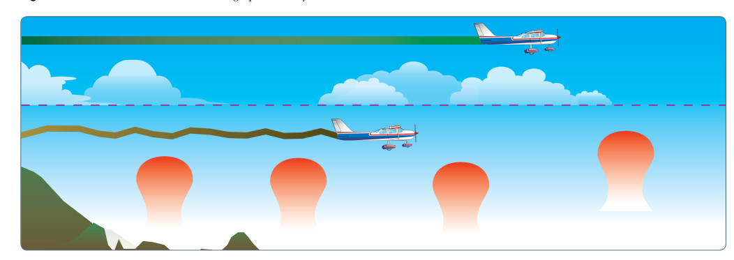
The updrafts inside a mature thunderstorm can exceed 6,000 feet per minute — far beyond the performance envelope of any consumer or commercial sUAS. Even outside the visible cloud boundary, invisible turbulence caused by outflow boundaries and gust fronts can extend many miles from the storm. A gust front — the leading edge of cold, dense air rushing outward from a downdraft — can produce sudden wind reversals that instantly overwhelm a multirotor's flight controller. Small UAS typically have a rated wind tolerance in the 20–35 mph range; convective outflow gusts routinely exceed 50 knots with little warning.
Lightning
Lightning is an electrostatic discharge that follows the path of least resistance to ground. A drone flying in the vicinity of a thunderstorm represents an elevated conductive object and can attract a strike — or simply be damaged by the massive electromagnetic pulse that accompanies nearby lightning activity. Beyond the loss of the aircraft, an uncontrolled drone falling from altitude in a populated area creates a direct safety hazard to people on the ground.
Heavy Rain and Hail
Most commercially available sUAS have limited or no weather-sealing. Heavy rain impairs rotor efficiency, can penetrate motor housings and electronics, and drastically reduces visibility for both the remote pilot and any onboard cameras. Hail — which can fall from the anvil of a storm well ahead of the main precipitation core — can physically destroy rotor blades and cause structural failure. Hail may reach the ground several miles away from the visible cell.
Reduced Visibility and Cloud Clearance
Part 107 requires remote pilots to maintain visual line of sight (VLOS) with their sUAS at all times. Thunderstorm-associated rain shafts, low ceilings, and scud can rapidly reduce visibility to near zero. Additionally, 14 CFR Part 107.51 specifies that sUAS must not be flown in clouds. Convective buildups can envelop an aircraft in seconds; once a drone enters a cloud, the remote pilot loses VLOS and violates the regulation regardless of intent.
Why Convective Avoidance Matters for Part 107 Pilots
Beyond the physical hazards, Part 107 imposes legal obligations that thunderstorm conditions routinely violate. Section 107.49 requires the remote pilot to assess weather conditions prior to flight and throughout the operation. Section 107.51 establishes minimum weather visibility (3 statute miles from the control station) and cloud clearance requirements (500 feet below, 2,000 feet horizontally from clouds). A developing cumulus congestus tower nearby may already violate these cloud clearance rules even before it becomes a full thunderstorm.
The broader safety framework also applies: under 107.23, no person may operate an sUAS in a careless or reckless manner that endangers life or property. Flying near convective activity that any reasonable pilot would recognize as hazardous would fall squarely into that category. The FAA's Risk Management Handbook emphasizes using a structured preflight risk assessment — convective weather is a top-tier hazard that should trigger a no-fly or postponement decision without hesitation.
Key Numbers and Rules
- 3 statute miles — minimum flight visibility required under Part 107 (14 CFR 107.51).
- 500 feet below clouds / 2,000 feet horizontally from clouds — minimum cloud clearance for sUAS operations in Class G airspace below 1,200 feet AGL (the most common operating environment).
- 400 feet AGL — standard maximum altitude ceiling for Part 107 operations, which does not exempt the pilot from weather minimums.
- Gust fronts can extend 10–15 miles or more ahead of a visible thunderstorm cell — the FAA Aviation Weather Handbook notes that the hazard area of a storm extends well beyond its visible boundary.
- No flight in or near thunderstorms — there is no regulatory minimum safe distance specified for thunderstorms by name in Part 107; the combination of VLOS, cloud clearance, and careless-or-reckless provisions effectively prohibit flight in or near convective weather.
- Preflight weather assessment is required — 107.49 makes it the remote pilot in command's explicit duty, not a suggested best practice.
Approved Weather Sources for Remote Pilots
Part 107 remote pilots are expected to use aviation-quality weather products, not just a consumer weather app. Several FAA-endorsed and public-domain sources provide the convective information needed for a sound preflight briefing.
Aviation Digital Data Service (ADDS) and the 1800wxbrief.com self-briefing portal provide access to METARs, TAFs, AIRMETs, SIGMETs, and convective SIGMETs. Convective SIGMETs (WST) are issued for severe thunderstorms, embedded thunderstorms, and squall lines, and are updated at least every 55 minutes. They describe the location, intensity, and movement of convective hazards and are among the most important preflight products a drone pilot can consult.
AIRMETs Sierra and Tango — issued for instrument meteorological conditions and turbulence respectively — may also flag pre-convective or post-convective conditions. Prog charts (prognostic charts) show expected positions of weather systems and can help a remote pilot plan days in advance to avoid flying during a convective outbreak. The National Weather Service radar (available through weather.gov) shows real-time radar returns and allows pilots to track storm cells by location, intensity, and movement.
For day-of situational awareness, the NEXRAD radar mosaic available through many aviation apps (ForeFlight, Garmin Pilot, etc.) provides near-real-time radar data. However, remote pilots must understand that radar data has a transmission delay of several minutes — a rapidly developing storm can look benign on radar and be fully mature by the time that data reaches a tablet. This is why a visual scan of the sky remains an irreplaceable part of convective avoidance.
Practical Avoidance Strategy
A sound convective avoidance routine for drone pilots follows a three-phase approach: check before you go, monitor while you fly, and know when to stop.
Before the flight, consult at minimum a standard weather briefing covering METARs, TAFs, convective SIGMETs, and radar trends for your operating area. Look specifically for convective language: terms like TSRA (thunderstorm with rain) in METARs, CB (cumulonimbus) in TAFs, or any active convective SIGMET covering your region. If the forecast shows even a slight chance of afternoon thunderstorms and your mission is not time-critical, consider moving the operation to the morning before convective heating builds.
During the flight, continuously scan the sky in all directions. Cumulus clouds building rapidly upward — especially if they develop cauliflower-like tops and begin darkening at the base — are warning signs of convective development. A sudden temperature drop, an increase in surface wind, or a shift in wind direction can indicate an approaching gust front. At the first sign of deteriorating convective conditions, land immediately. A drone can be rescheduled; an accident cannot be undone.
Common Test Traps
- Assuming distance equals safety. The FAA knowledge test may present a scenario where a thunderstorm appears several miles away. Remember that gust fronts, hail, and turbulence can affect aircraft well beyond the visible storm boundary — distance alone is not sufficient justification to fly.
- Confusing visibility minimums with cloud clearance. Part 107 requires both 3 SM visibility AND specific cloud clearances. A pilot who sees 3 miles of visibility but is only 300 feet below a developing cloud base is still in violation.
- Thinking the dissipating stage is safe. A collapsing thunderstorm still produces significant downdrafts and gusty outflow; hazards do not disappear when rain stops.
- Relying on consumer weather apps alone. Apps like a phone's built-in weather service do not provide METARs, TAFs, or convective SIGMETs. The FAA expects remote pilots to access aviation-quality weather products.
- Underestimating rapid development. Fair-weather cumulus can develop into a mature thunderstorm in less than 30 minutes on a hot, humid afternoon. A clear sky at launch does not guarantee a clear sky 20 minutes into a flight.