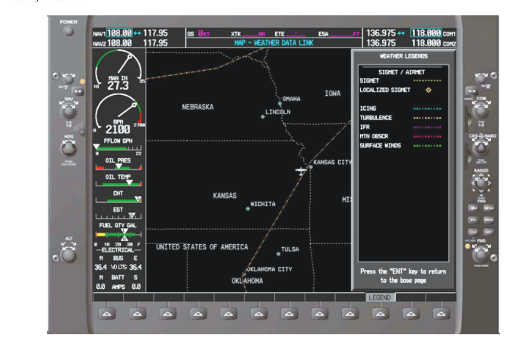
When forecasters at the Aviation Weather Center (AWC) detect atmospheric conditions that can threaten aircraft safety, they issue formal advisories broadcast across the NAS — SIGMETs (Significant Meteorological Information) and AIRMETs (Airmen's Meteorological Information). These products are not casual weather observations; they are structured, time-limited advisories with specific criteria, coverage requirements, and regulatory implications. For instrument-rated pilots, interpreting them correctly is a daily operational skill, not just a test topic. This article walks through every layer of these products — what triggers them, how to read them, and how to use them in go/no-go and route decisions.
Both SIGMETs and AIRMETs are classed as inflight weather advisories and are issued independently of routine METARs and TAFs. They supplement, but do not replace, those reports. You will encounter them in preflight planning through tools like 1800wxbrief.com and the AWC website, and you may receive them inflight via HIWAS (where still active), ATC advisories, or onboard datalink weather services.
What Is a SIGMET?
A SIGMET covers non-convective weather phenomena that are potentially hazardous to all aircraft, regardless of category or experience level. The criteria for issuing a SIGMET include severe or extreme turbulence not associated with thunderstorms, severe icing not associated with thunderstorms, widespread dust storms or sandstorms lowering visibility below three miles, and volcanic ash. These are the big-ticket atmospheric hazards that can overwhelm even transport-category aircraft systems.
SIGMETs in the contiguous United States are identified by an alphabetic designator — November (N) through Yankee (Y), excluding Sierra and Tango, which are reserved for AIRMETs. A SIGMET is valid for up to four hours from time of issuance, except that volcanic ash and tropical-cyclone SIGMETs may be valid for up to six hours. Each SIGMET covers a defined geographic area described in VOR or lat/lon terms and must cover at least 3,000 square miles of airspace.
A typical SIGMET text might read: SIGMET NOVEMBER 3 VALID UNTIL 2100Z...WA OR ID...SEVERE TURB BTN FL250 AND FL390. DUE TO JET STR. RPRTD BY ACFT. CONDS CONTG BYD 2100Z. Breaking that apart: the product name and sequence number confirm this is the third issuance of SIGMET November; the validity period tells you when it expires; the state abbreviations bound the geographic area; the phenomenon (severe turbulence) and altitude band tell you where in the vertical column it exists; and the cause and continuation statement help you judge whether conditions may outlast the advisory.
Convective SIGMETs — A Special Category
Convective SIGMETs (WSTs) are issued for thunderstorm-related hazards and follow a completely separate set of rules. They are issued by the AWC for the contiguous 48 states and cover:
- Severe thunderstorms (surface winds of 50 knots or greater, hail at the surface of 3/4 inch diameter or greater, or tornadoes)
- Embedded thunderstorms
- A line of thunderstorms at least 60 nautical miles long with thunderstorms affecting at least 40% of its length
- An area of thunderstorms covering at least 3,000 square miles with thunderstorms affecting at least 40% of the area
Convective SIGMETs are issued at 55 minutes past each hour for each of three geographic regions (eastern, central, and western U.S.) and as special issuances when conditions warrant. They are valid for two hours from issuance. Critically, convective SIGMETs imply severe or extreme turbulence, severe icing, and low-level wind shear — even if those phenomena are not explicitly stated. If a convective SIGMET is active for your route, assume all of those embedded hazards exist until proven otherwise. No pilot certificate or instrument rating makes you immune to what a mature thunderstorm cell can do to an airframe.
What Is an AIRMET?
AIRMETs cover weather that is significant but of a lower threshold than SIGMET criteria, and they are specifically intended to alert single-engine and light twin aircraft and VFR pilots — though IFR pilots must understand and use them too. AWC issues AIRMETs on a scheduled basis: an initial forecast is issued at 0245Z and then updated every six hours at 0845Z, 1445Z, and 2045Z, with unscheduled amendments as needed. Each AIRMET is valid for six hours from issuance time.
There are three distinct AIRMET types, each assigned a specific code word:
- AIRMET Sierra (S) — IFR Conditions: Covers areas where ceilings are forecast to be below 1,000 feet and/or visibility below 3 statute miles affecting 50% or more of the area at any one time. This is critically important for IFR planning because widespread IFR conditions mean alternates may be harder to find and approach minima may be marginal across a broad region.
- AIRMET Tango (T) — Turbulence: Issued for moderate turbulence, sustained surface winds of 30 knots or greater at the surface, or non-convective low-level wind shear (LLWS). Moderate turbulence may not be structural-failure territory, but it is enough to injure unsecured occupants and fatigue pilots on long flights.
- AIRMET Zulu (Z) — Icing: Covers moderate icing and, importantly, specifies the heights of the freezing level. For IFR pilots, Zulu is often the most insidious advisory: structural ice accumulation on an aircraft not certified for flight in known icing conditions is a life-threatening emergency, and even certified aircraft have equipment limits.
Why These Advisories Matter for IFR Operations
Understanding SIGMETs and AIRMETs isn't simply about passing the knowledge test — it directly influences legal compliance and risk management. Under 14 CFR 91.103, pilots must familiarize themselves with all available information concerning a flight before departure. That explicitly includes weather reports and forecasts, and courts and NTSB administrative law judges have consistently interpreted SIGMET and AIRMET availability as part of that obligation. Launching into a route with an active convective SIGMET without having reviewed it — and made a conscious decision — is a serious lapse in preflight duty.
Inflight, ATC has a responsibility under the AIM to advise pilots of SIGMETs and Convective SIGMETs when workload and frequency congestion permit, but you cannot rely solely on ATC to catch everything. Datalink weather products, flight-following with FSS, and pilot reports (PIREPs) complement these formal advisories and help you build a real-time mental picture of the atmosphere.
Key Numbers and Rules
- SIGMET validity: up to 4 hours (non-convective); up to 6 hours for volcanic ash and tropical cyclones
- Convective SIGMET validity: 2 hours; issued at :55 past the hour for each U.S. region
- AIRMET validity: 6 hours; scheduled updates every 6 hours starting at 0245Z
- SIGMET geographic minimum: 3,000 square miles
- Convective SIGMET line criteria: thunderstorms along at least 60 NM of a line, affecting 40% of its length
- Convective SIGMET area criteria: at least 3,000 square miles, with thunderstorms over 40% of the area
- AIRMET Sierra ceiling threshold: below 1,000 feet AGL and/or visibility below 3 SM over 50% of the area
- AIRMET Tango sustained wind threshold: 30 knots or greater at the surface
- SIGMET designators: N through Y, excluding Sierra (S) and Tango (T) — those are reserved for AIRMETs
Memory Aid
Use the phrase