Of all the weather phenomena a pilot may encounter, thunderstorms stand alone as the most violent and potentially lethal. A mature thunderstorm can generate strong winds, large hail, lightning, severe turbulence, and rapid icing — sometimes all at once, and in extreme cases winds can exceed 100 knots and hail can grow to the size of baseballs. The FAA is unambiguous on this point: no civilian aircraft is truly thunderstorm-proof, and no pilot should attempt to fly through one. To make sound go/no-go decisions and to understand the weather briefings and radar products that support those decisions, every student pilot must understand how thunderstorms form, how they evolve through their life cycle, and what specific hazards each stage presents.
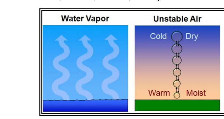
Thunderstorms belong to the broader family of convective weather. Convection is the vertical movement of air driven by temperature differences — warm, moist air rises, cools, and eventually releases latent heat that accelerates further lifting. When this process becomes vigorous enough and sufficient moisture and instability are present, ordinary cumulus clouds grow into the towering giants known as cumulonimbus (Cb) clouds. The FAA's Aviation Weather Handbook (FAA-H-8083-28) identifies three essential ingredients for thunderstorm formation: a source of lift, atmospheric instability, and sufficient moisture.
The Three Ingredients for Thunderstorm Development
Lift is the trigger that gets the convective process started. It can come from surface heating (air masses warmed by the sun becoming buoyant), frontal boundaries (warm air being forced upward over cooler air along a cold or warm front), orographic lifting (terrain forcing air upward over mountains), or convergence zones (surface winds flowing together and being forced aloft). Each mechanism can independently initiate convection, and when two or more act simultaneously the results are especially explosive.
Atmospheric instability determines whether rising air will continue to accelerate upward or will be suppressed. The atmosphere is unstable when the environmental lapse rate — the rate at which the surrounding air temperature decreases with altitude — exceeds the rate at which a rising parcel of air cools. A rising parcel that remains warmer than its surroundings will keep climbing. Conditionally unstable air, which is stable in its dry state but becomes unstable once lifted to saturation, is especially common in thunderstorm-prone environments because the release of latent heat during condensation provides an additional energy boost.
Moisture supplies both the fuel (latent heat released during condensation) and the visual cue (cloud formation). A high moisture content in the lower and middle troposphere lowers the lifted condensation level and ensures that once convection begins, condensation occurs rapidly and provides sustained energy for updrafts.
The Three Life-Cycle Stages of a Thunderstorm
Stage 1: The Cumulus Stage
The cumulus stage is characterized by a dominant, continuous updraft throughout the developing cell. Warm, moist air rises, condenses, and releases latent heat, which makes the rising air parcel warmer — and therefore more buoyant — than the surrounding environment. This positive feedback causes the updraft to intensify rapidly. During this stage, precipitation is forming inside the cloud but has not yet reached the ground; the updrafts are strong enough to suspend water droplets and ice crystals aloft. Turbulence inside the cumulus stage cell is significant, and the cloud top grows quickly as new turrets continuously build upward. From the outside, the cloud appears bright white with a hard, cauliflower-like texture as new turrets continuously build upward.
Stage 2: The Mature Stage
The mature stage begins when precipitation reaches the surface — the classic indicator that a thunderstorm is fully developed. This is the most intense and most hazardous stage of the thunderstorm life cycle. Both strong updrafts and strong downdrafts exist simultaneously within the storm. The downdraft is initiated by precipitation drag and the evaporative cooling of falling rain, which creates a column of cold, sinking air. Where the downdraft reaches the surface and spreads outward, it forms the gust front — a sharp boundary of cold, gusty air that can precede the storm's visible precipitation by several miles. The gust front itself can produce sudden windshifts, severe low-level wind shear, and microbursts, all of which pose extreme danger during takeoff and landing.
Inside the mature cell, updrafts and downdrafts in close proximity create extreme turbulence that can exceed the structural limits of any general aviation aircraft. The cloud top has pushed into the upper troposphere and may overshoot into the stratosphere. At these altitudes the cloud top spreads horizontally in the distinctive anvil shape, blown downwind by upper-level winds. The anvil marks the tropopause — the boundary layer that acts as a ceiling for convection. Lightning is most frequent during this stage, and large hail is produced as ice pellets cycle up and down within the storm, accumulating layers of ice with each circuit.
Stage 3: The Dissipating Stage
As precipitation continues and the downdraft expands, it eventually cuts off the inflow of warm, moist surface air that was feeding the updraft. Without its energy source, the updraft weakens and then ceases. The storm is now dominated entirely by downdrafts. Precipitation decreases, the cloud top begins to erode, and the cumulonimbus loses its crisp, hard edges, taking on a fibrous, cirrus-like appearance — especially at the anvil. The cell dissipates, though it may still produce lightning and turbulence. Importantly, in a multi-cell or squall-line environment, the outflow from a dying cell can trigger new cumulus development nearby, so overall storm activity may persist even as individual cells go through their life cycle.
Major Thunderstorm Hazards
The FAA categorizes thunderstorm hazards into several specific phenomena, each of which is independently dangerous:
- Turbulence: Severe to extreme turbulence exists both inside the storm and in clear air near it, and can be encountered up to 20 nautical miles from severe or strong storm cells, particularly beneath the anvil. FAA guidance (AIM 7-1-28) recommends avoiding severe thunderstorm cells by at least 20 nautical miles when deviating.
- Lightning: Lightning can cause temporary blindness, damage avionics and fuel systems, and ignite fuel vapors. It can strike aircraft even when the aircraft is not directly in the storm cloud.
- Hail: Large hail can be thrown out from the storm by strong upper-level winds and encountered in clear air miles from the storm itself. Hail can destroy propellers, shatter windshields, and cause fatal structural damage.
- Icing: Severe icing can occur throughout the storm's vertical extent. Supercooled water droplets freeze instantly on contact with the airframe, and the storm can produce icing at altitudes where you would not normally expect it.
- Low-level wind shear and microbursts: The gust front ahead of a mature storm can generate sudden, dramatic changes in airspeed and wind direction at low altitude — precisely when the aircraft has minimal energy margin for recovery during approach or departure.
- Tornadoes: The most violent storms, particularly supercells, can produce tornadoes — columns of rotating air whose wind speeds vary widely, with only the most extreme tornadoes reaching or exceeding 300 mph. Tornadoes may exist entirely beneath the cloud base and may be obscured by rain.
- Reduced visibility and precipitation: Heavy rain and hail can reduce visibility to near zero and obscure terrain, obstacles, and other aircraft.
Key Numbers and Rules
- 20 nautical miles: The FAA-recommended minimum lateral distance to maintain when deviating around a severe thunderstorm, even in VMC.
- Three ingredients: Lift + Instability + Moisture — all three must be present for thunderstorm development.
- Three life-cycle stages: Cumulus (updraft dominant), Mature (updrafts and downdrafts; most hazardous), Dissipating (downdraft dominant).
- Cumulonimbus (Cb): The cloud type associated with thunderstorms; a key symbol on aviation weather charts and METARs (CB reported in sky condition).
- Gust front: Can precede the storm by several miles; associated with sudden wind shifts and microburst activity.
- Never fly through: No general aviation aircraft is certified for intentional flight into a known thunderstorm.
Memory Aid
To remember the three ingredients required for thunderstorm development, use LIM: Lift, Instability, Moisture. If any one of these three elements is missing, a thunderstorm cannot form. When all three are present — especially in abundance — conditions are ripe for severe convective activity, and pilots should be on high alert regardless of current sky conditions, since storms can develop rapidly.
Common Test Traps
- The mature stage is the most dangerous, not the largest: The FAA knowledge test frequently asks which stage is most hazardous. The correct answer is the mature stage — it features simultaneous updrafts, downdrafts, lightning, hail, and maximum turbulence intensity.
- Hazards exist outside the visible cloud: Many students assume that staying clear of the visible cloud boundary is sufficient. In fact, severe turbulence, hail, and lightning can be encountered in clear air up to 20 nm from a severe storm.
- A dissipating storm is still dangerous: The dissipating stage still contains turbulence and lightning, and its outflow may trigger new cell development nearby. Do not assume a weakening storm is a safe storm.
- The anvil points downwind — and toward hidden danger: High-altitude winds can carry hail well beyond the anvil's visible edge. Hail is possible even when flying under what appears to be benign cirrus ahead of a storm system.
- Embedded thunderstorms are especially treacherous: Thunderstorms hidden within larger cloud masses (common in warm frontal systems) cannot be seen visually. Instrument pilots are especially vulnerable, which is why onboard weather radar or ATC assistance is critical in IMC near convective activity.