When you check the weather before a flight, you're typically looking at the finished products — METARs, TAFs, AIRMETs — numbers and codes that tell you what the meteorologist expects the atmosphere to do. But have you ever wondered why the forecast looks the way it does, or how confident the forecaster actually is? That's exactly where the Area Forecast Discussion (AFD) comes in. Written in plain, conversational prose by the National Weather Service (NWS) meteorologist on duty, the AFD pulls back the curtain on the reasoning, assumptions, and uncertainties that drive official aviation forecasts. For a pilot, learning to read an AFD is like getting a private briefing from the forecaster themselves.
The AFD is not a regulatory requirement to review before flight, but it is one of the most powerful weather tools available to pilots who want to go beyond surface-level forecast data. The FAA and aviation training community strongly encourage pilots to seek a thorough preflight weather briefing — and the AFD is a key piece of that puzzle, especially when weather is complex, marginal, or highly uncertain.
What the AFD Is and Where It Comes From
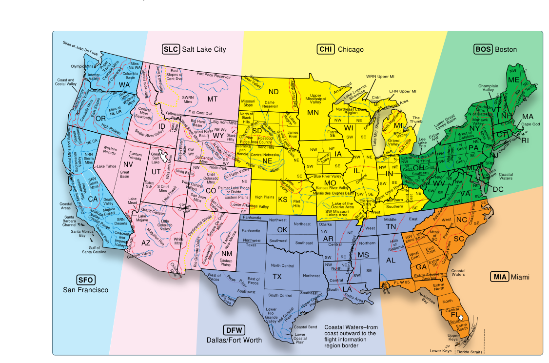
The Area Forecast Discussion is issued by individual NWS Weather Forecast Offices (WFOs). The continental United States is divided into dozens of local WFO areas, each responsible for producing forecasts for its region. When a meteorologist at a WFO creates or updates a forecast — such as a Terminal Aerodrome Forecast (TAF) or a zone forecast — they also write an AFD that explains their thinking. AFDs are typically updated several times per day, and a new discussion is issued whenever significant changes are made to the forecast.
You can access AFDs through aviationweather.gov (the Aviation Weather Center website), through standard weather briefing services such as 1800wxbrief.com, and through many flight planning apps. On aviationweather.gov, navigate to the "Forecasts" menu and select "Area Forecast Discussion" to find the discussion for any NWS office covering your route of flight.
How the AFD Is Organized
Although the exact format can vary slightly between WFOs, most AFDs follow a recognizable structure with labeled sections. Understanding these sections helps you pull out exactly the information you need quickly.
- Synopsis: A broad overview of the large-scale weather pattern affecting the region — jet stream position, frontal systems, high and low pressure centers, and how those features are expected to evolve. This is your big-picture situational awareness. If you're flying across multiple WFO regions, compare synopses side-by-side for the full story.
- Short-Term (or Near-Term) Forecast Discussion: Covers roughly the next 6 to 24 hours, depending on the office. This is where the forecaster digs into specifics: when a cold front will arrive, what time ceilings are expected to lower, where convective initiation is most likely, and how confident they are in the timing. This section is often the most actionable for day-of-flight planning.
- Long-Term Forecast Discussion: Extends the discussion beyond the short-term, often out to five to seven days. Uncertainty naturally increases with time, and good forecasters say so explicitly here. Phrases like "models are in poor agreement" or "confidence is low" are critical red flags for pilots planning trips several days out.
- Aviation Section (if present): Some WFOs include a dedicated aviation sub-section that speaks directly to IFR conditions, turbulence, icing, or other flight-significant weather. Not every office does this, but when it's there, it's gold for pilots.
- Fire/Marine/Hydrology Sections: These appear at some offices and can be skipped by most pilots unless the weather phenomenon (like a dry, gusty wind event) has obvious aviation relevance.
Reading Forecaster Language and Uncertainty Cues
One of the most valuable skills you can develop as a pilot-weather consumer is learning to read the probabilistic language forecasters use in AFDs. Unlike the definitive-sounding language of a TAF or AIRMET, AFDs reveal the confidence level behind those products. Here are the kinds of phrases to watch for:
- "High confidence" / "Models in good agreement": The forecaster believes the forecast is likely to verify. Plan with reasonable confidence, but always have alternates.
- "Low confidence" / "Models diverge significantly": The atmosphere is in a complex or chaotic state. Even experienced meteorologists aren't sure what will happen. This is a major signal for pilots: if the expert is unsure, you should build in extra margins, delay, or be prepared to divert.
- "Timing uncertainty": The forecaster knows the event will happen (a front passage, a squall line) but isn't sure exactly when. This matters enormously for flights near the time window in question.
- "Ensemble guidance suggests..." or "The GFS and Euro disagree...": References to numerical weather models. You don't need to know the models in detail; you just need to know that when models disagree, uncertainty is high.
Forecasters also use hedging words deliberately. "Could," "may," "chance," and "possible" signal lower confidence, while "will," "expect," and "likely" signal higher confidence. Pay attention to these subtle word choices — they're not accidents.
Why the AFD Matters for Flight Safety
TAFs and METARs give you the forecast and the current observation, but they don't tell you what might go wrong with that forecast. The AFD fills that gap. Consider a scenario: your TAF shows VFR conditions all day, but the AFD for the same area says "high uncertainty in afternoon convective timing; isolated strong storms possible if daytime heating exceeds model expectations." That TAF is technically correct based on the most likely scenario, but the AFD reveals there's a meaningful chance of surprises. A pilot who skips the AFD might depart confidently into a situation that deteriorates faster than the official forecast suggested.
The AFD is especially valuable in these situations:
- Marginal VFR or IFR days: When ceilings and visibility are near minimums, small forecast errors matter enormously. The AFD tells you how much the meteorologist trusts their own numbers.
- Convective weather season: Thunderstorm forecasting is inherently uncertain. The AFD often reveals whether forecasters expect an "active" or "quiet" severe weather pattern and what triggers they're watching.
- Frontal passages: Knowing the expected timing confidence of a front can determine whether to depart early, wait, or cancel.
- Mountain flying: Orographic lift, wave activity, and obscuration by terrain make mountain weather notoriously hard to predict. AFDs for mountain WFOs often contain specific discussion of wind and icing that is absent from standard products.
Key Numbers and Rules
- AFDs are issued by individual NWS Weather Forecast Offices; the NWS operates 122 Weather Forecast Offices covering the United States and its territories.
- AFDs are generally issued at least twice daily, and often more frequently — every few hours — depending on the WFO and how quickly weather is evolving, rather than following a fixed update cycle.
- The AFD is a public-domain product available free of charge through aviationweather.gov, 1800wxbrief.com, and most EFB apps.
- The AFD does not replace a standard weather briefing from a Flight Service Station (FSS) or automated briefing system; it supplements it.
- For flights crossing multiple WFO regions, you should read AFDs from each relevant office, as weather regimes can differ sharply across a route.
Integrating the AFD Into Your Preflight Routine
Think of the AFD as the last thing you read after reviewing the standard products. Start with the big picture: pull up the synopsis section to understand the overall pattern. Then read the short-term section carefully, noting any explicit uncertainty statements, timing questions, or model disagreements. If an aviation section exists, read it word for word. Finally, compare what you've read against the official products — TAFs, AIRMETs, prog charts — to see if the AFD's nuances change how you interpret them.
Building this habit takes only an extra five to ten minutes on most days, and on those complex weather days when forecasting is hardest, those minutes can be the difference between a safe flight and a dangerous one. Experienced pilots and instrument-rated aviators routinely cite the AFD as one of their most-used weather resources precisely because it offers something no coded product can: the genuine reasoning of a trained meteorologist who has been watching your airspace all day.
Common Points of Confusion
- Confusing the AFD with the Area Forecast (FA): The old FA (now largely replaced by Graphical Forecasts for Aviation) was a coded forecast product, not a narrative discussion. The AFD is always a plain-language discussion explaining forecast reasoning — these are completely different products.
- Thinking the AFD replaces a weather briefing: The AFD supplements but does not replace a proper preflight weather briefing. FAA regulations and best practices still call for a complete briefing covering all relevant products.
- Assuming AFD confidence language is informal: Forecasters use probabilistic language deliberately and consistently. "Could" and "will" mean very different things in an AFD, and understanding how forecasters communicate uncertainty is a useful real-world skill, even though the current FAA Private Pilot knowledge test does not specifically test AFD probabilistic language.
- Believing one AFD covers an entire cross-country route: Each WFO only discusses its own area. Long cross-country flights may pass through three, four, or more WFO regions, each with its own AFD and potentially very different weather.
- Overlooking the AFD during VMC days: Students sometimes think the AFD is only for bad weather. In reality, reading it on a clear day builds the habit and the skill so you're fluent with it when weather turns marginal.