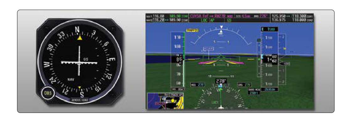
When you earn your instrument rating, you quickly learn that not all ILS approaches are created equal. Sometimes the glideslope component of an ILS is out of service, under maintenance, or simply not approved for a particular procedure. In those cases, you fly what is called a localizer-only approach (abbreviated LOC on the approach chart). Understanding the fundamental differences between a full ILS and a localizer-only approach — in terms of equipment, minimums, technique, and decision-making — is essential both for the FAA instrument knowledge test and for real-world flying in the clouds.
This article breaks down exactly how these two approach types differ, why those differences exist, and what you as the pilot need to do differently when the glideslope is not in the picture.
How the ILS Works: A Quick Review
An Instrument Landing System (ILS) is a precision approach system that provides two independent radio guidance signals to a pilot flying toward a runway in instrument meteorological conditions (IMC). The localizer transmits a horizontally oriented signal that centers the aircraft on the runway extended centerline. The glideslope transmits a vertically oriented signal that guides the aircraft down a precise descent path — typically a 3-degree glide angle — toward the runway touchdown zone.
When both components are operative and the approach is authorized, you have a full ILS approach. The FAA classifies the ILS as a precision approach because it provides both lateral and vertical electronic guidance down to decision altitude (DA). The glideslope is the feature that makes precision approaches special: it tells you not just whether you are left or right of centerline, but also whether you are above or below the correct descent path at every moment during the approach.
What Changes on a Localizer-Only Approach
A localizer-only approach uses only the localizer signal for lateral guidance. The glideslope is deliberately ignored — either because it is out of service (NOTAM'd), because the procedure was never designed with glideslope authority, or because you are flying a different localizer-based procedure such as a Localizer Back Course (LOC BC) approach. Without glideslope, the approach is reclassified by the FAA as a non-precision approach (NPA).
This single change — losing vertical guidance — cascades into several important operational differences.
Higher Minimums
The most immediately noticeable difference on your approach chart is the minimums. On a full ILS, you fly to a Decision Altitude (DA), which is typically expressed as an MSL altitude. Decision altitude on a CAT I ILS is commonly 200 feet above touchdown zone elevation, with a visibility minimum of 1/2 statute mile (or 2,400 feet RVR) at most airports, though specific procedure minimums vary.
When you fly the same runway's localizer-only procedure, the approach is now non-precision. Instead of a DA, you fly to a Minimum Descent Altitude (MDA), and the MDA is almost always significantly higher than the ILS DA — often 300 to 500 feet higher, sometimes more. Visibility requirements also increase. The reason is straightforward: without the glideslope to precisely control descent, the FAA must provide a larger obstacle clearance buffer because the pilot's vertical path is less precisely monitored.
Decision Altitude vs. Minimum Descent Altitude
This distinction is exam-critical. On a precision approach (ILS), you fly to a DA. At the DA, you make an immediate decision: if you have the required visual references to land, you continue; if not, you execute a missed approach immediately. The DA is a point in space — you do not level off and search for the runway.
On a non-precision approach (LOC-only), you fly to and then level off at the MDA. You are permitted to continue flying level at the MDA — within the time constraints of the approach — while looking for the required visual references. Only when you have those references and can make a normal descent to the runway may you descend below the MDA. If you reach the Missed Approach Point (MAP) without the required visual references, you execute the missed approach. The MAP on a LOC-only approach is typically defined by a distance, a time, or a fix — not by altitude alone.
Vertical Guidance Technique
Flying a full ILS, you follow the glideslope needle continuously. It is an active instrument you scan and correct against throughout the approach. The glideslope provides a roughly 3-degree descent path, which equates to approximately 300 feet of altitude loss per nautical mile, or at a typical approach speed of 90 knots, roughly a 450–500 foot-per-minute descent rate. You are always receiving feedback on whether you are high or low.
On a localizer-only approach, you must self-manage your descent. There are two common techniques. The first is a step-down approach: you descend to each published step-down fix altitude as you cross those fixes, eventually reaching the MDA and leveling off. The second, and preferred modern technique where published, is to use a Vertical Descent Angle (VDA) or Visual Descent Point (VDP) depicted on the approach chart to fly a stabilized, continuous descent to the MDA. The VDA is advisory only — it is not an authorized glidepath — but it helps you fly a stabilized profile rather than diving to the MDA at the last moment.
The Visual Descent Point (VDP) is a charted point on final approach from which a normal descent from MDA to the runway touchdown zone can be made. If you cannot see the runway by the VDP, a normal landing is increasingly unlikely, and you should seriously consider the missed approach even before reaching the MAP. The VDP is identified on charts with a small "V" symbol.
Why It Matters: Safety and Situational Awareness
The absence of glideslope guidance introduces the risk of a Controlled Flight Into Terrain (CFIT) event. Without the glideslope needle pushing you away from terrain and obstacles, you must be deliberate and disciplined about when and how you descend. Descending below the MDA without the required visual references is a serious — and potentially fatal — error. The MDA exists to protect you from terrain, obstacles, and obstructions in the final approach area.
There is also the risk of flying an unstabilized approach. If you dive steeply from your last step-down altitude to the MDA right before the runway threshold, you may arrive at the MDA fast, high, and out of configuration, making a safe landing impossible. Using the VDA and treating the LOC-only approach with the same disciplined, stabilized-approach mindset as the ILS is essential.
Additionally, pilots must be alert: if the glideslope receiver is functioning in the cockpit but the glideslope is NOTAMd out of service, the glideslope needle may give erratic or misleading indications. Disregard the glideslope needle entirely during a LOC-only approach — it is not authorized and may be unreliable.
Key Numbers and Rules
- ILS = Precision Approach: provides lateral (localizer) and vertical (glideslope) guidance; uses Decision Altitude (DA).
- LOC-only = Non-Precision Approach: lateral guidance only; uses Minimum Descent Altitude (MDA) and a Missed Approach Point (MAP).
- Typical ILS glideslope angle: 3 degrees (approximately 300 ft/nm altitude loss).
- LOC-only MDA: almost always higher than the ILS DA for the same runway — often several hundred feet higher.
- Visual Descent Point (VDP): charted advisory point; if you cannot see the runway here, a normal landing is unlikely.
- Glideslope needle on LOC-only: disregard it — it may be unreliable or NOTAMd out.
- Required visual references to descend below MDA: defined in 14 CFR 91.175; must have at least one of the listed references (runway environment, approach lights, etc.) and be in a position for a normal descent to landing.
- LOC signal width: approximately 3 to 6 degrees full-scale deflection depending on runway length; same signal used for both ILS and LOC-only approaches.
Memory Aid
A widely used reminder for descending below minimums is the phrase "Not below the MDA without the three A's: Authorized, Able, and in position to Accomplish a normal landing." While not an official FAA acronym, it captures the three conditions of 14 CFR 91.175(c): you must have the required visual reference, the flight visibility must meet minimums, and you must be in a position from which a normal landing can be completed. If any of those three conditions is not met, do not descend — go missed.
Common Test Traps
- DA vs. MDA confusion: The FAA knowledge test frequently asks whether a given approach uses DA or MDA. ILS = DA (precision). LOC-only = MDA (non-precision). Never mix these up.
- Assuming the same minimums: Students sometimes assume flying a LOC-only approach gives ILS-equivalent minimums. It does not — always check the LOC-only minimums box on the chart separately from the ILS minimums box.
- Using the glideslope needle on a LOC-only: If the glideslope is out of service, ignore the glideslope indicator. Flying it anyway is a dangerous error and may be tested conceptually.
- Missing the MAP: On a non-precision approach, missing the Missed Approach Point because you were focused on the MDA altitude is a classic trap. Know your MAP definition (fix, distance, or time) before you start the approach.
- VDP is advisory, not a hard limit: The VDP tells you whether a normal landing is practical, but it is not a regulatory hard stop like the MAP. Confusing the two is a common test and practical error.